At vero eos et accusamus et iusto odio dignissimos ducimus qui blanditiis praesentium voluptatum deleniti atque corrupti quos dolores et quas molestias excepturi sint occaecati cupiditate non provident, similique sunt in culpa qui officia deserunt mollitia animi, id est laborum et dolorum fuga.
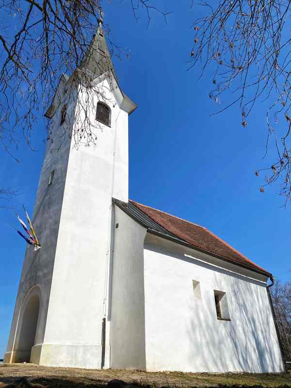
Šentviška gora or Church of St. Vid (386 m) is an extremely popular excursion point for the citizens of the municipality of Brežice and you are invited to read, to find out why.
Not far away from the old town of Brežice to the south, the view stops at a hill with a church called “Šentvid”. Šentvid offers countless paths and trails, so each conquest of it can be different. You can choose the “direct” way to the top and conquer it in a good 25 minutes, or you can choose a more gradual ascent and ring the church bell at the top after a 1 hour and 15 min walk. No matter which path we choose, the markings will always lead us in the right direction to the top, where a view of the entire Krško-Brežice field awaits us. Let’s not forget to mention that we can also choose Čatež’s energy path, where energy vortices accompany us along the way.
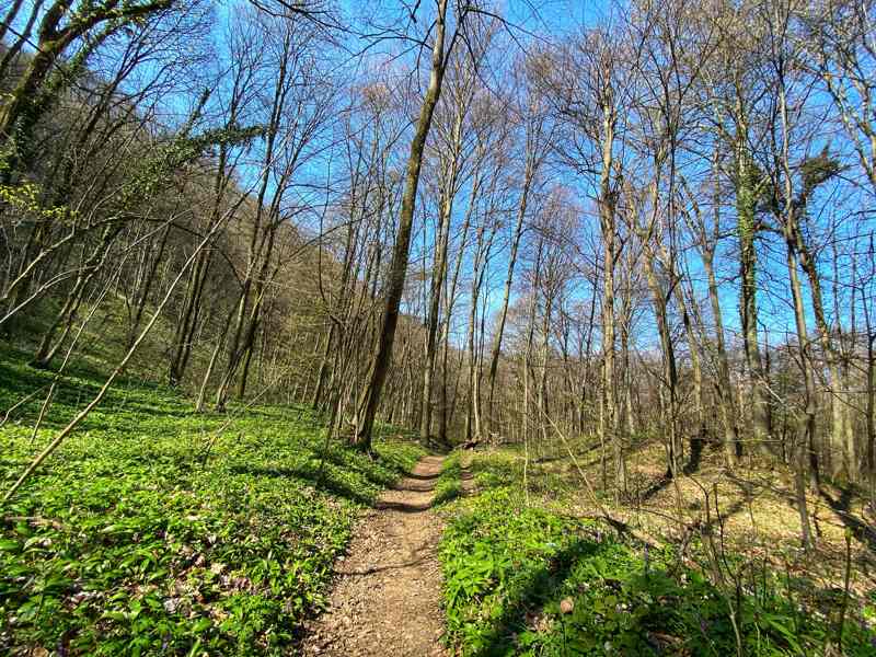
In the background of Šentviška gora stretches the slope of Goli Cirnik, whose highest peak is Goli – or more correctly – Veliki Cirnik (621 m). The mountain trail from Šenvid is marked well. We follow the signs from the village of Žejno to Veliki Cirnik. In the gallery, you will see white dots in the photos, which I followed when conquering Veliki Cirnik directly from the village of Žejno, past the village playground through Bambreg. The Brežice mountain trail, which runs across Šentviška gora, also leads to Veliki Cirnik. The websiteof the local mountaineering association of Brežice describes the course of the trail in more detail.
At the top of Veliki Cirnik, benches with tables are waiting for us at the bivouac “Pri veseli Micki”, where we can calm down and enjoy the nature and views that surround us.
Some basic information for the conquest of Veliki Cirnik from Čatež ob Savi:
Starting point: Čatež ob Savi
Difficulty: easy marked path
Length: 6 km
Walking time: 2 h 20 min (average pace)
Recommended time of year to visit: all seasons
The trip is suitable for hiking and family trips, as the trail is also suitable for children.
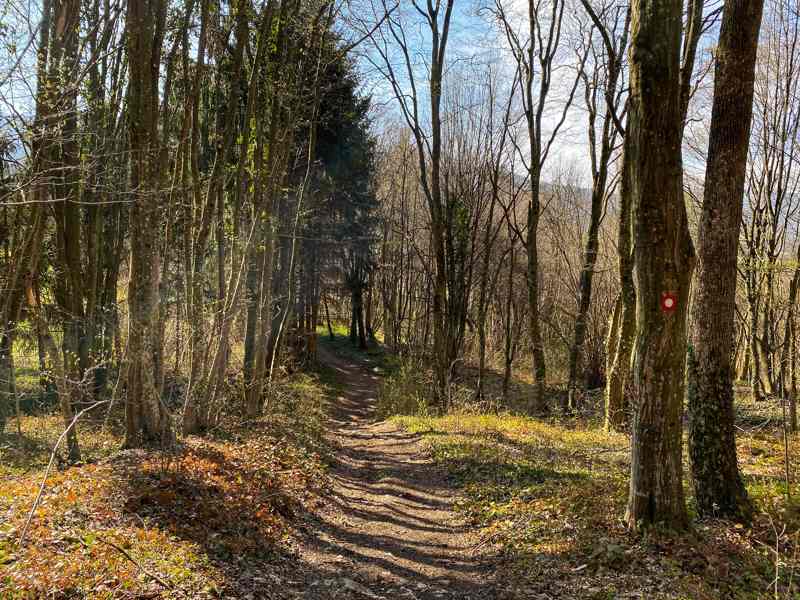
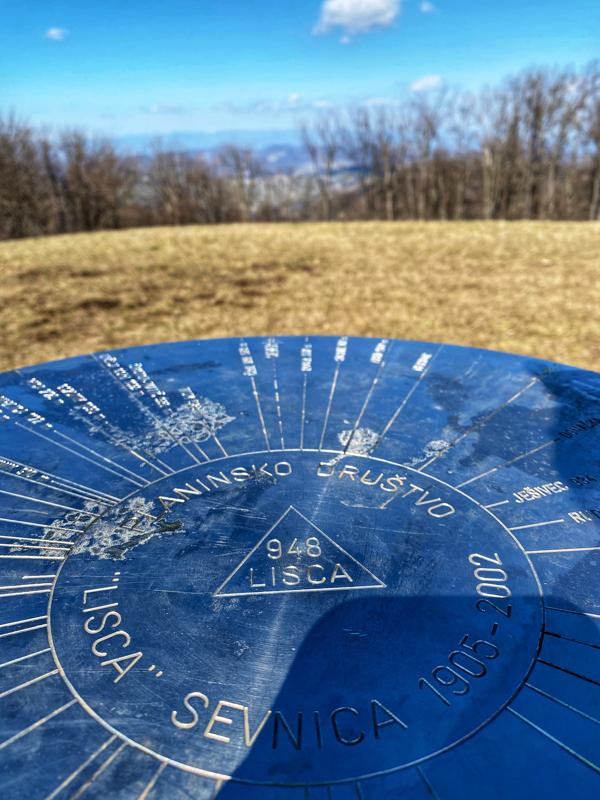
Our Posavje hills have a special touch, which may win you over at first, but if not, they will enchant you with the second step. Lisca is certainly one of the most striking peaks of the Posavje hills, with its height of 947 meters above sea level. It is an extremely popular excursion point, as it enables conquest for more fitness affine as well as less prepared recreationists with several starting points.
Lisca offers hiking, climbing and cycling trails, as well as being accessible by car. However, we prefer to focus on conquering Lisca “on foot”. The mountain trails are nicely and clearly marked, so there is no reason to be afraid to stray from the path. My favourite route is from Krakovo (starting point). The trail leads us through forests, villages and meadows, and in good weather conjures up views far and wide.
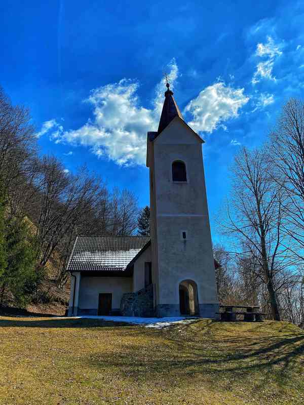
Just below the top, the path leads us past the church of St. Jošt, from where it is only a few minutes to the top of Lisca. Two mountain huts, Tončkov dom and Jurkova koča greet us at the top. Where they instantly have an excellent culinary offer, from classic mountain menus to a little more modern cuisine, pancakes :=). At the highest point, just a minute away from the hut, is one of the two radar meteorological stations in Slovenia.
In good weather, Lisca offers views all the way to Triglav and the admiration of paragliders, which together with the wind have the Posavje in the palm of your hand. The conquered peak will also enrich the “green” Diary of the Slovenian mountain trail, as it is one of the peaks of the Extended Slovenian mountain trail.
Here are some basic facts about conquering Lisca from Krakovo:
Starting point: Krakovo (Mastnak wine cellar; arranged parking lot opposite the cellar)
Difficulty: easy marked path
Length: 4 km
Walking time: 1 h 45 min (average pace)
Recommended time of year to visit: all seasons
In any case, we must not forget that there is also a bench of love on Lisca, which we can already find on quite a few Slovenian peaks. So, if the above didn’t convince you yet, let me mention that the location of the bench itself offers a kind of privacy where you can enjoy the views of the hills that open up in front of you, and you feel like you have them in the palm of your hands in an instant.
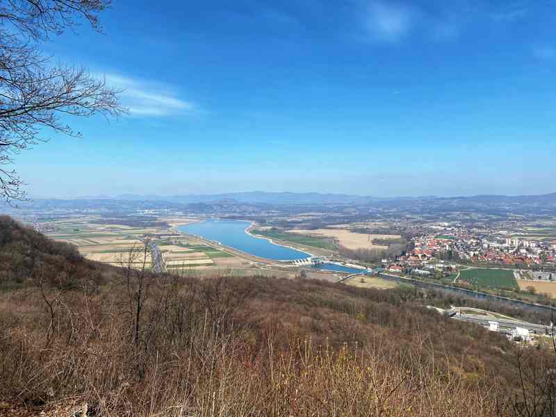
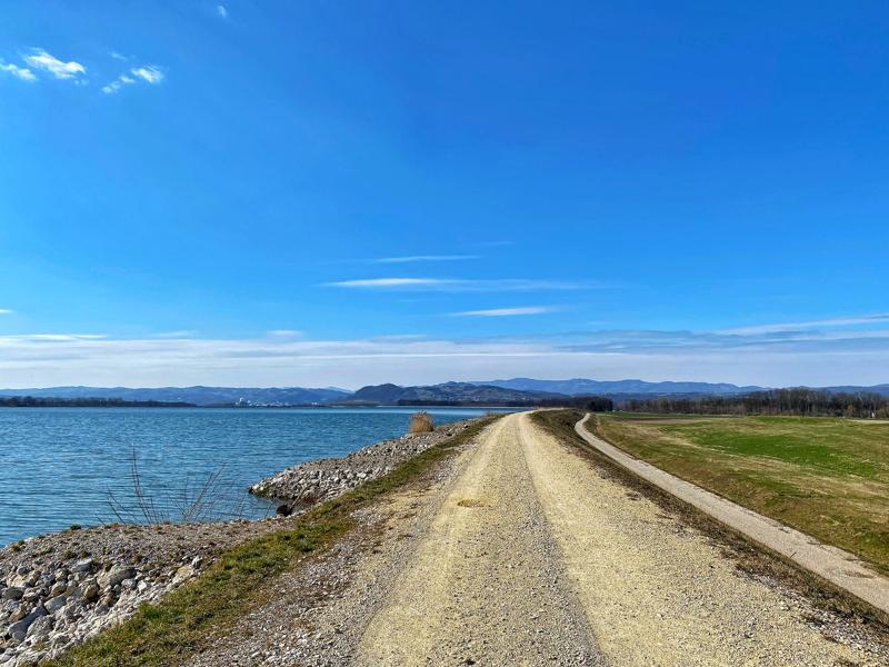
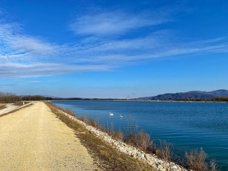
A trip to the Brežice accumulation lake – the “Brežice Sea”
For some, it is a paradise on the other side of the world, but for me, it is our “Brežice sea”. Here time stops, as the walking path along the Sava offers quite a few kilometres, where the river and the sky meet; an oasis of blue.
If you are a fan of walking paths where you stay at the same altitude, then this is the perfect location for your recreation. The lake with its two banks, the “Styrian” and “Carniolan” sides, offers a beautifully landscaped path, suitable for walking, running or cycling.
The Styrian side of the lake has a 6.5 km long route that stretches from the Brežice Hydroelectric Power Plant (HPP) to the dams of the Krško Nuclear Power Plant (NPP). In the direction of the Krško NPP, we have the Sava on our left side, and almost within arm’s reach, on the right side first Vrbina and in the distance the centre of Brežice. The trail is worth visiting in fine, sunny weather, especially when it is not very windy. It is in the open, and on windy days it can spoil our idyllic time there. Therefore, it is advisable to check the weather forecast prior, to have the best from our trip.
We will be accompanied by swans and ducks all the way, and we can also spot a common tern and a river gull. The four artificial islands located in the central part of the accumulation lake take care of the fauna. The islands serve as resting places for waterbirds, as only there can they find peace.
The proposed trip is suitable for very active, as well as not so fit individuals and families. We can turn around at any time and return to Brežice HPP, to the starting point.
Some basic information for the “Styrian part” of the route from the Brežice HPP to the Krško NPP dams:
Length: 6.5 km one way, a total of 13 km
Walking time: 2.5 h (average pace)
If all this has not yet convinced you, our “Brežice sea” is just behind Lake Ptuj in total surface area. It is the second-largest lake in Slovenia, it is as big as two lake Bled’s. Why this is a paradise on earth – where nature can charm one to forget for a few moments about everyday things – can be found in the picture gallery.
The Carniolan side is still in need of exploration, and a contribution will be featured in a future follow up.
Are you interested in renting the apartment Vinska Trta? Call us.
Ribnica 28D,
8261 Jesenice na Dolenjskem,
Slovenia
+386 41 416 920
apartma.vt@gmail.com
Reachable24/7
We use cookies to ensure that we give you the best experience on our website. If you continue to use this site we will assume that you are happy with it.OkPrivacy policy